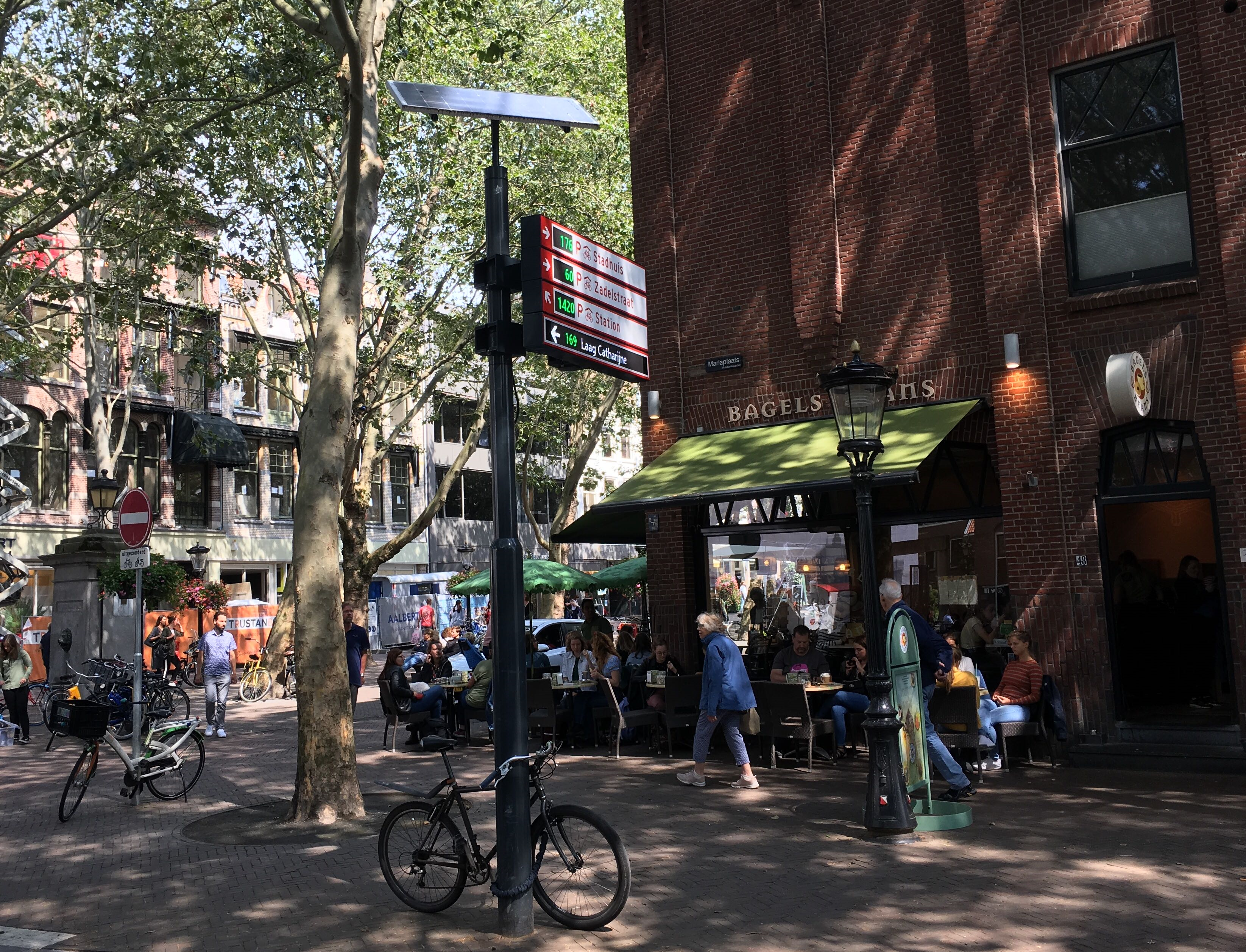
Route Information System
Our Route Information System consists of interactive street signs giving real-time information on the location and availability of bicycle and car parking spots.

Improve Wayfinding to Parking Facilities
The Route Information System will help you to create a more efficient way of directing cyclists and car drivers to available parking spots. This will reduce irritation levels in commuters and help to unclog the inner cities.
A Route Information System consists of a number of digital signs dotted around the city, and located on the busiest commuter routes. The signs will show the direction of the parking facilities and the number of available parking spaces. It is usually linked to an existing Parking Management System in these facilities.
If you would like to show dynamic messages to your commuters, DRIP (Dynamic Route Information Panel) solutions might be the best choice for you: these full LED-matrix signs can show varying messages on for instance alternative parking options, opening hours, city events etc.
The Route Information System
Solar-powered or grid-powered.
Various designs and colours.
Real-time information with 4G data connections.
Take a look at our case study and projects here.


